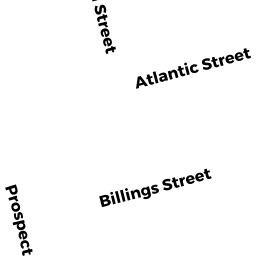
203 ATLANTIC ST
Owner Information
FAHERTY BRIAN
41 HOLMES ST
QUINCY, MA 02171


Property Details
203 ATLANTIC ST is classified as a Apartments with Four to Eight Units (Apartments).
The primary structure on this property was built in 1910. There are 5,937ft2 of built area within this property. There is 3,292ft2 of residential/living space within this property. This property is listed as having 19 rooms.
203 ATLANTIC ST is valued at $754,600. The land is valued at $292,900 and the structures are valued at $449,700. There is an additional valuation of $12,000 on this property.
This property is in Zone RES B. Confirm with local Zoning Board authorities to ensure there are no overlays or other easements on this property.
The most recent deed for 203 ATLANTIC ST is recorded at the local registrar in Book 20957, Page 0143. 203 ATLANTIC ST was last sold on Tuesday, May 4, 2004 for $580,000.
Assessment data from fiscal year 2020.
Flood Data
According to the FEMA National Flood Hazard Layer, this property does not appear to be in a flood zone. It may also be in an area not yet reviewed. Nonetheless, confirm this information prior to taking any action.
To view the flood hazards around this property, create a FEMA "Firmette" Map of the area around 203 ATLANTIC ST.
Broadband Internet Providers
| Provider | Type | Bandwidth (mbps) | |
|---|---|---|---|
| VSAT Systems, LLC. | Satellite | 2 | 1 |
| Comcast | Cable | 1000 | 35 |
| Starry, Inc. | Fixed Wireless | 200 | 200 |
| T-Mobile | Fixed Wireless | 25 | 3 |
| GCI Communication Corp. | Satellite | 0 | 0 |
| HughesNet | Satellite | 25 | 3 |
| Verizon New England Inc. | DSL | 7 | 0 |
| Viasat Inc | Satellite | 100 | 3 |
Broadband service provider data from December 2020.
Adjacent Properties
- 166 BILLINGS ST
Three-Family Residential owned by YU MING KUN - 199 ATLANTIC ST
Two-Family Residential owned by ALVARADO PETER A - 176 BILLINGS ST
Other, Open Space owned by 176 BILLINGS STREET - 176 BILLINGS ST #1
Condo owned by ZHANG MELVIN - 176 BILLINGS ST #2
Condo owned by MAI JIA QUAN - 176 BILLINGS ST #3
Condo owned by HU ZHONGFENG - 207 ATLANTIC ST
Two-Family Residential owned by PINKHAM CRAIG A